
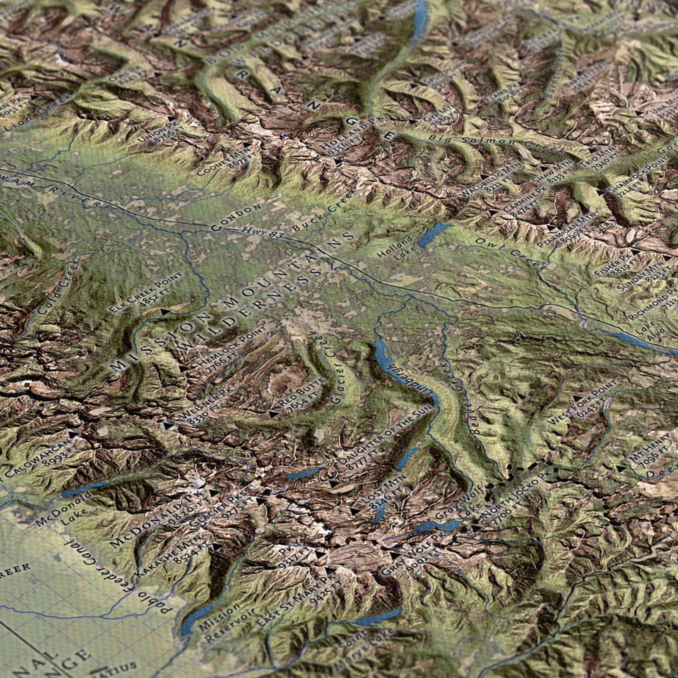
Crown of the Continent
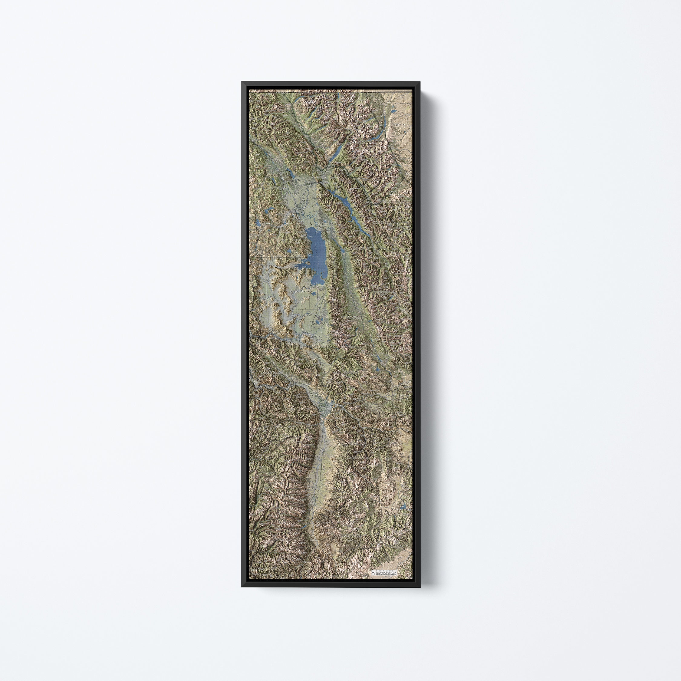
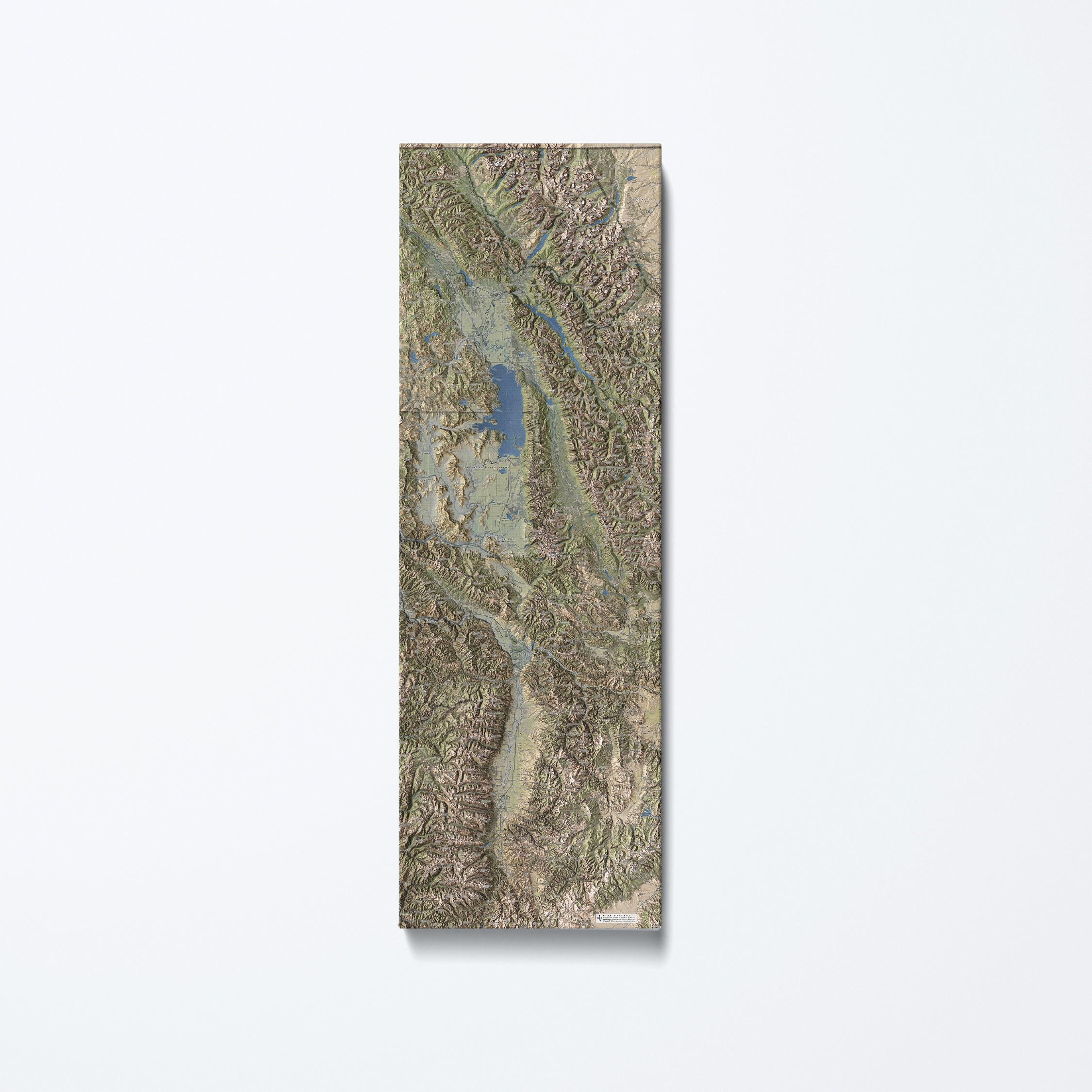
Five Valleys Canvas Map
$200.00
-
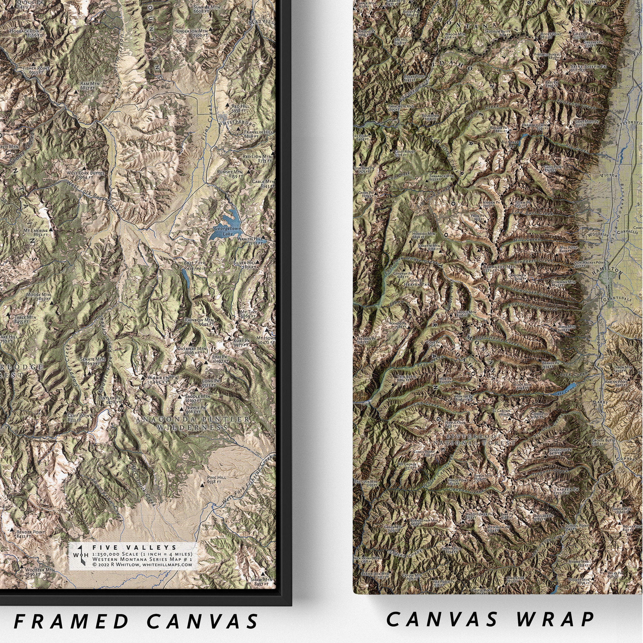
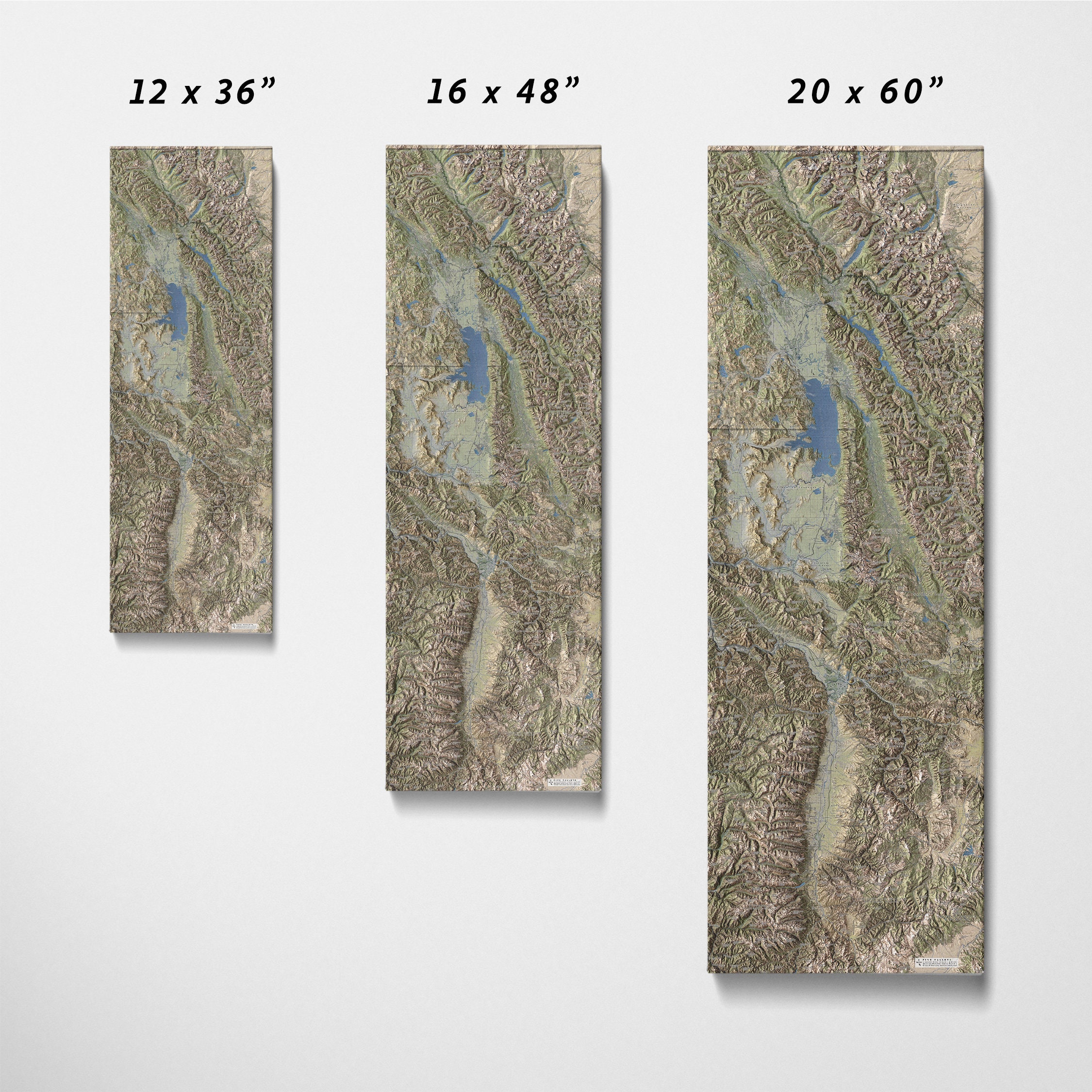
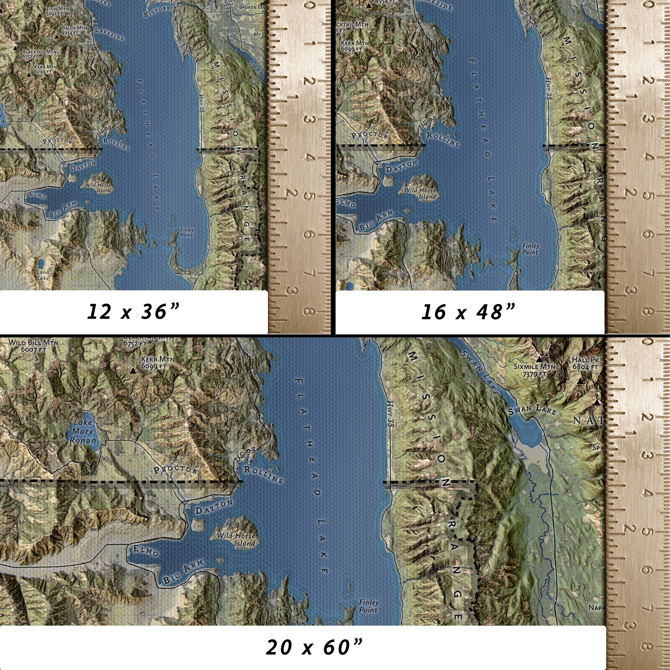
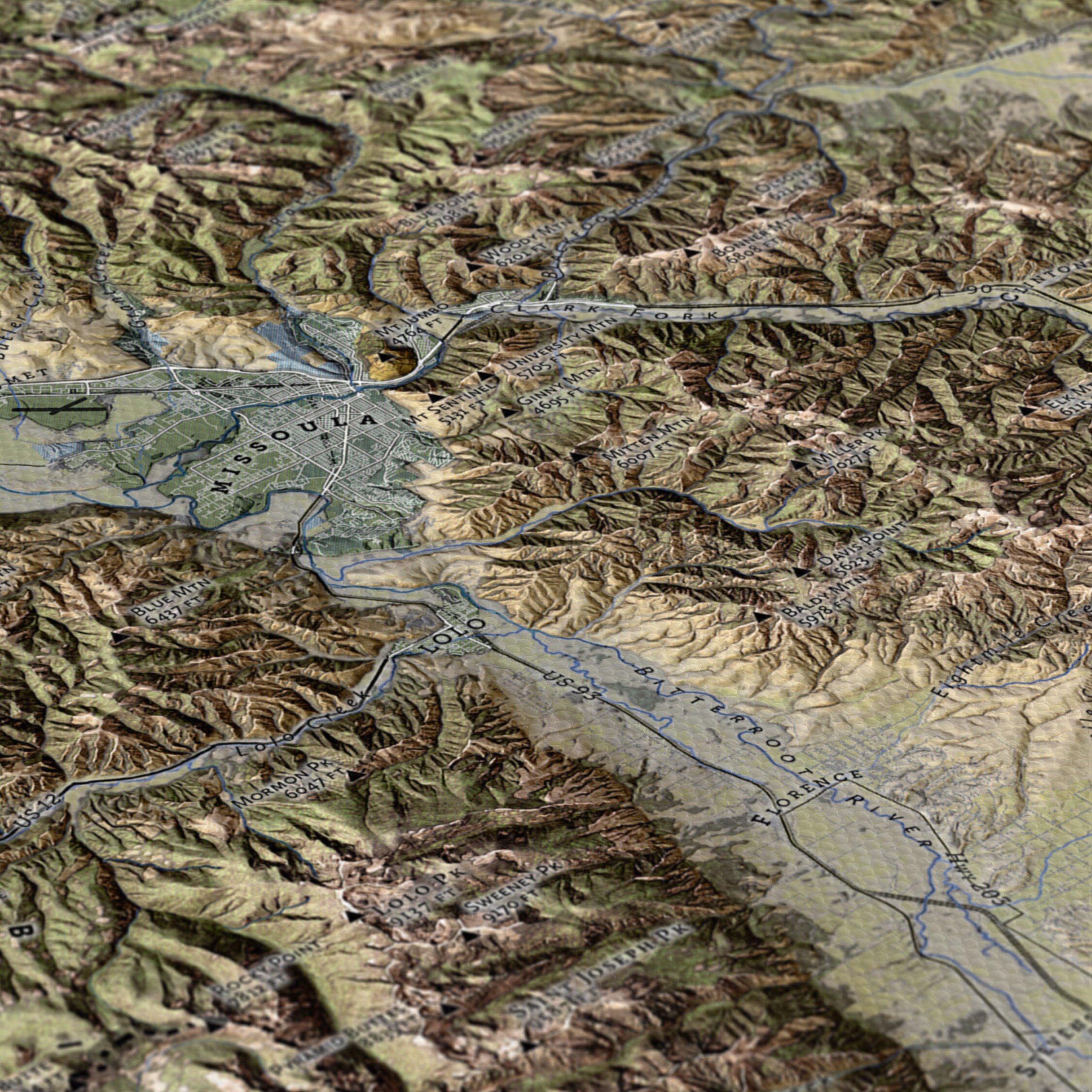
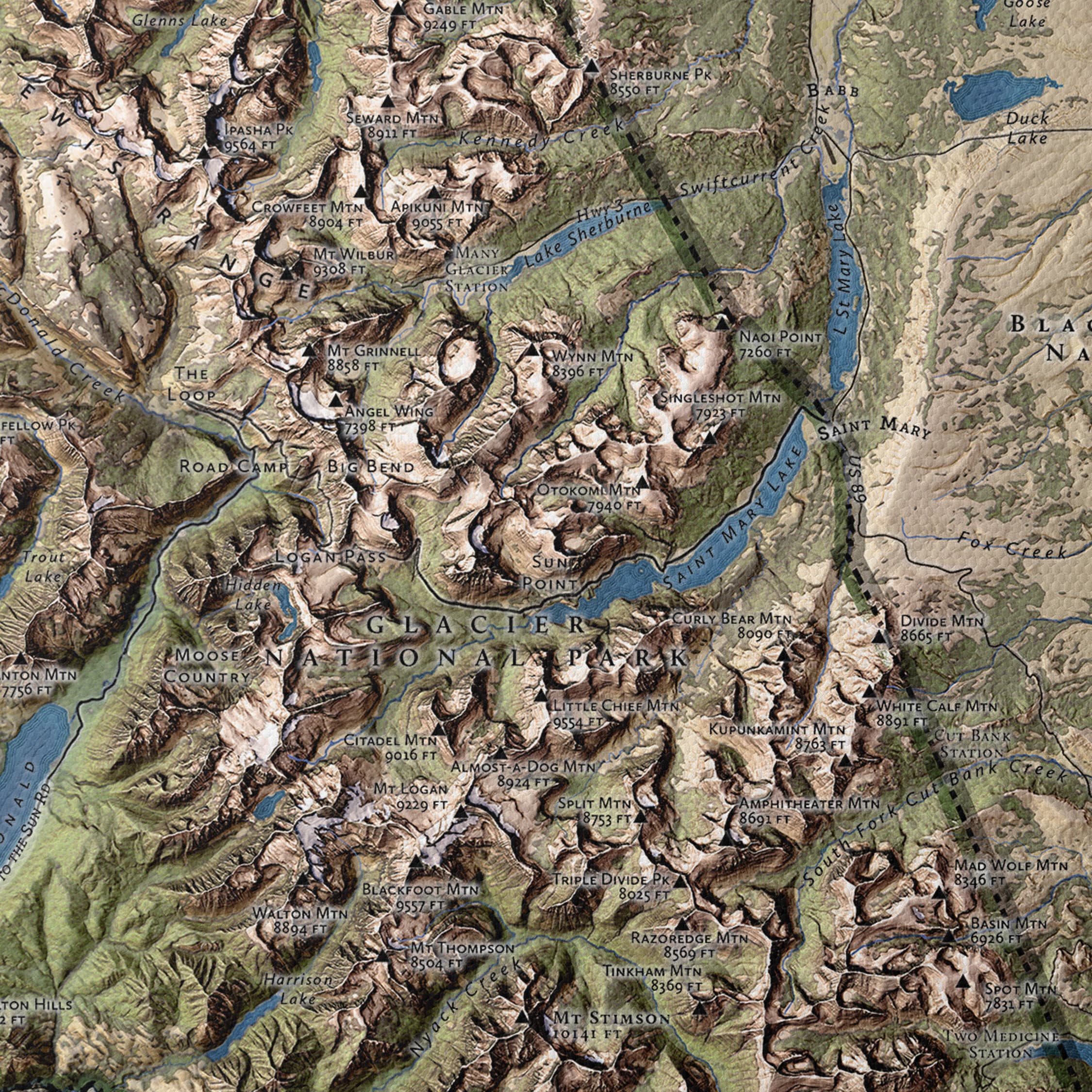
DetailsThis 20x60 inch map of the Five Valleys around Missoula, MT is printed on gallery canvas wrap. The map is printed at 1:250,000 scale, so 1 inch on the map covers about 1.5 miles. That means landmarks like the Clark Fork and Bitterroot Rivers are recognizable! Hand-placed labels make it easy to find cities, parks, roads, lakes, rivers, and mountains. Careful attention to detail makes this Whitehill Map a memorable gift for anyone with a passion for western Montana.
Whitehill Maps are not reproductions of vintage maps or satellite images. Each map is designed “from scratch” using open-source data from the U.S. Geological Survey and Forest Service. Through careful study of the real-world location and close attention to detail, I create maps that are recognizable enough for you to find your favorite road, river, or lake, even if it’s not a famous landmark!
MATERIALS
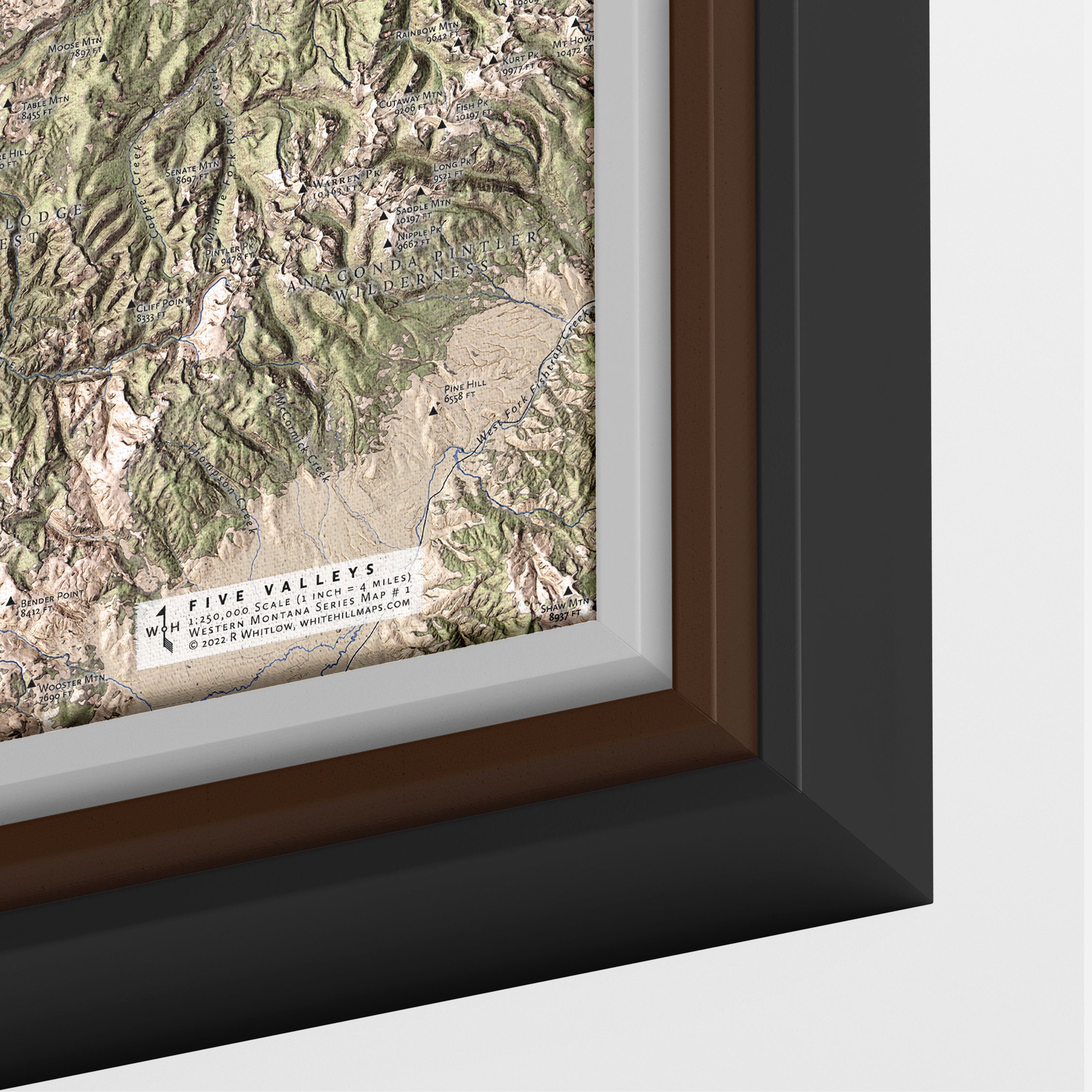
Maps are printed on artist-grade canvas wrapped on a 1.25 inch frame. The canvas wrap ships assembled and ready to hang.
Canvas maps can be framed in a 1.25 inch wide floating frame with satin black finish. Overall dimensions of a framed canvas map are 21.25 x 61.25 x 1.75 inches. To order a framed canvas map, select ""Floating Frame"" from the ""Material"" dropdown menu.
SHIPPING
After placing your order please allow 3-5 days for shipping. Shipping is included in the listing price and maps ship via UPS or USPS, depending on destination.
Whitehill Maps collaborates with production partners to print and ship large canvas wall art and framed prints. To ensure prompt delivery, our production partners will sometimes ship your map directly to you. -
Shipping & Policies
Shipping from United States
Processing time
3-5 business days
Estimated shipping times
- North America : 3 - 5 business days
I'll do my best to meet these shipping estimates, but can't guarantee them. Actual delivery time will depend on the shipping method you choose.
Customs and import taxes
Buyers are responsible for any customs and import taxes that may apply. I'm not responsible for delays due to customs.
Payment Options
Returns & Exchanges
Returns & exchanges accepted within 30 days
Buyers are responsible for return shipping costs. If the item is not returned in its original condition, the buyer is responsible for any loss in value.
The following items can't be returned or exchanged
Because of the nature of these items, unless they arrive damaged or defective, I can't accept returns for:
- Custom or personalized orders
Conditions of return
Buyers are responsible for return shipping costs. If the item is not returned in its original condition, the buyer is responsible for any loss in value.
Privacy policy
Whitehill Maps collects shipping information and shares it with third parties (e.g. UPS) for the purpose of delivering your order. The Whitehill Maps Etsy shop may be required to maintain this information in order to comply with legal and/or tax obligations.
The Whitehill Maps Etsy shop does not collect or retain personal information for other purposes.
The above refers only to the Whitehill Maps shop. Please refer to Etsy's privacy policy for more information.Frequently Asked Questions
Sizing details
Each map's print size is included in the product title and description.
All maps printed on watercolor rag include a rough border approximately 0.5 inches wide.
All maps printed on canvas are stretched across a 1.5" fiberboard backing.Print Materials
Maps are printed either on textured watercolor rag or canvas wraps. Please message me if you would like a map printed on a different material.
Gift wrapping and packaging
All maps are packaged with plastic sleeves and cardboard reinforcement to protect them during shipment.
Maps 11x14" and smaller are shipped flat. Maps 12x16" and larger are shipped rolled up.
Gift wrapping for maps is not offered at this time.