

Crown of the Continent
Beartooth Mountains Map, Large-scale Shaded Relief Map, Canvas Wall Art
$175.00
-
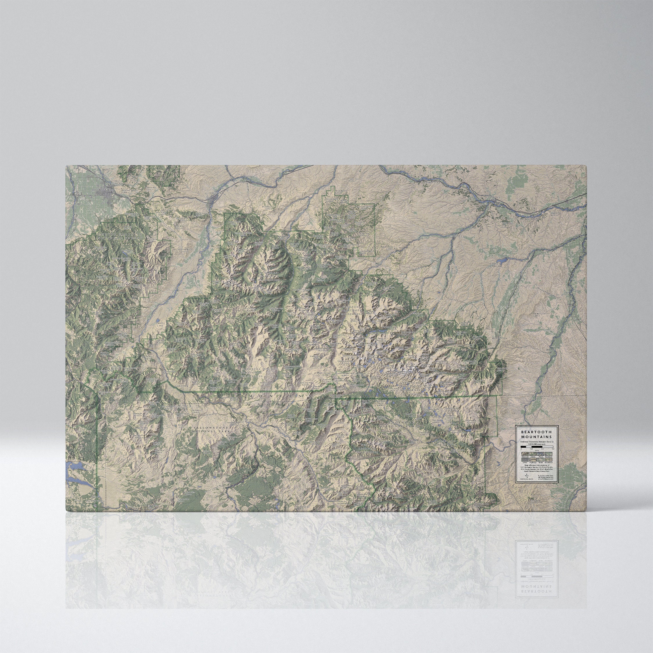
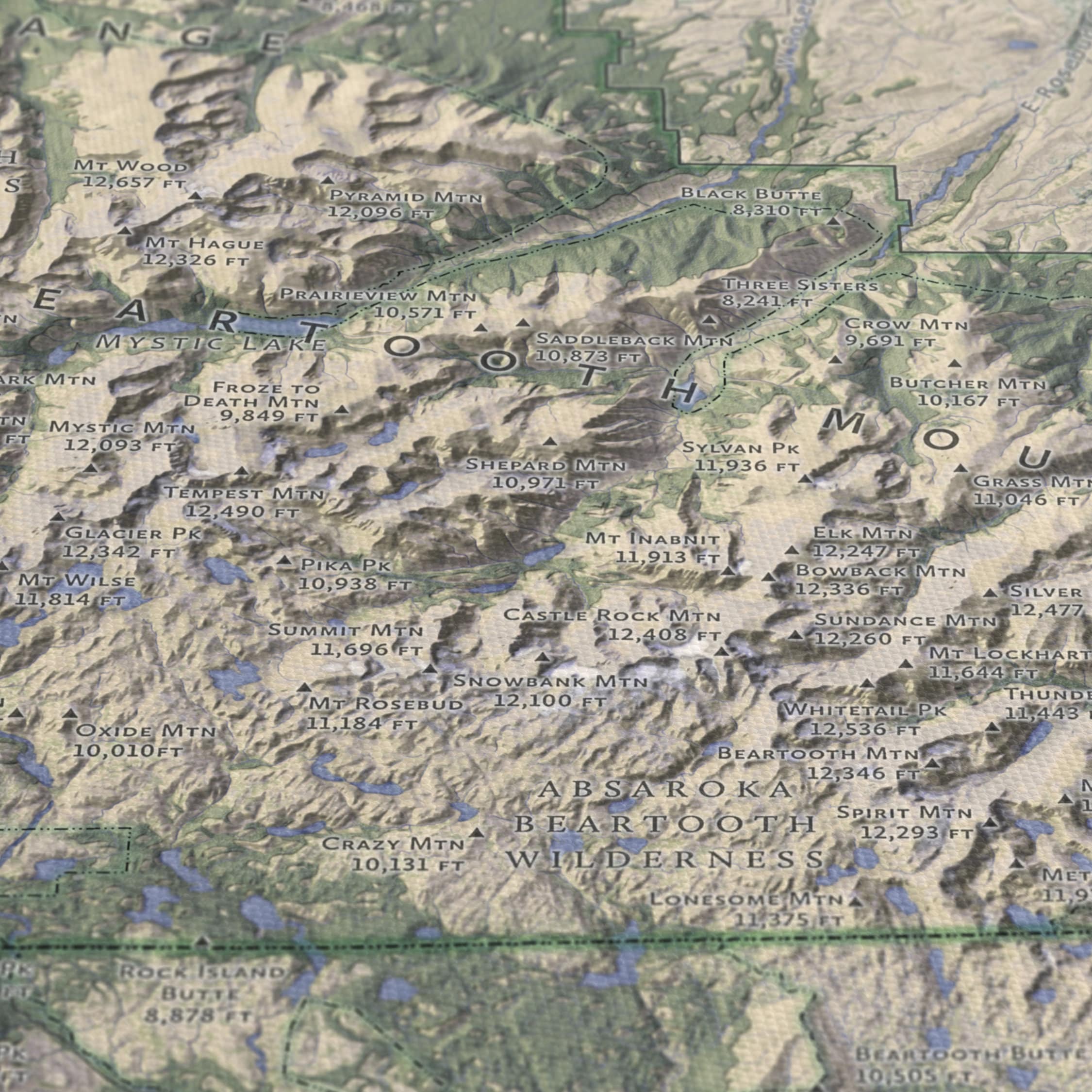
DetailsThe towering and rugged Beartooth Mountains straddled Montanan and Wyoming. Inside the range are 41 of the state’s highest peaks, as well as ten highland plateaus and hundreds of lakes.
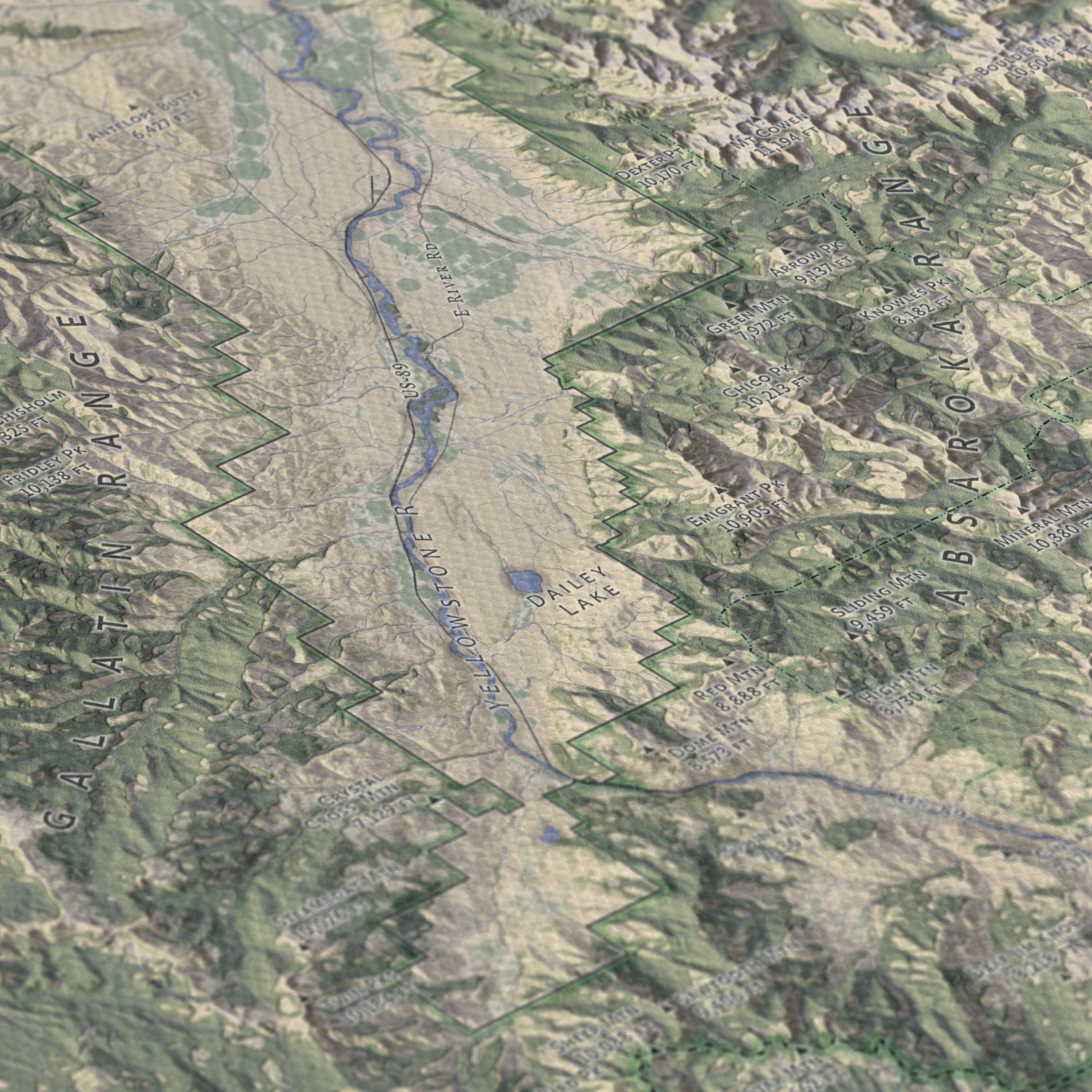
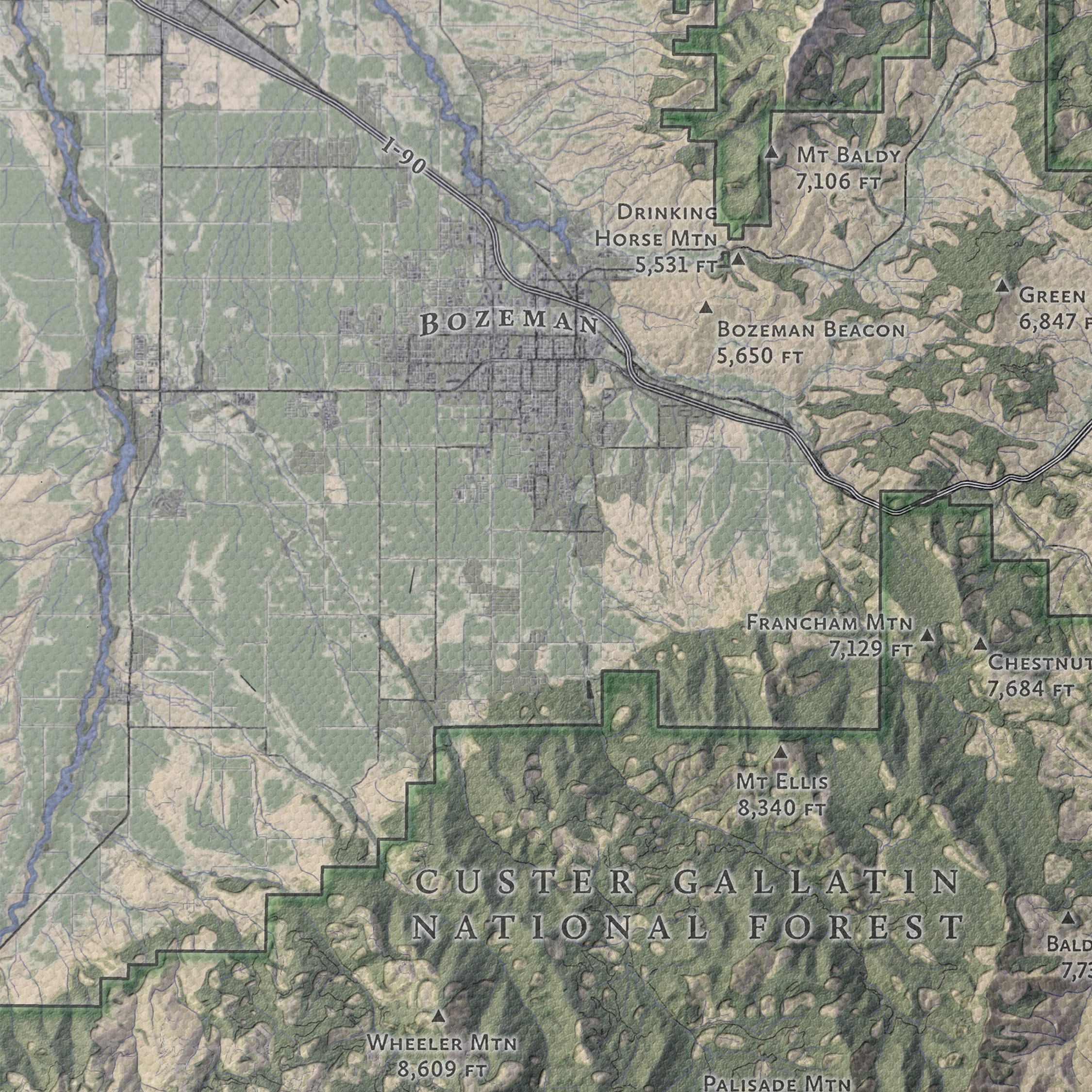
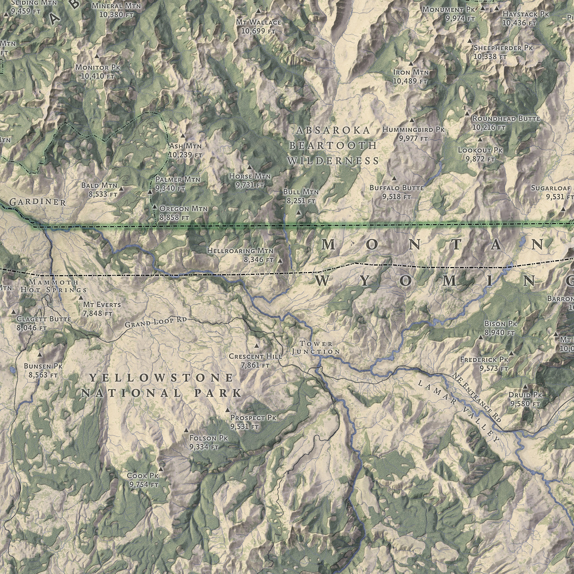
This map features the Beartooth Mountains, the Absaroka Beartooth Wilderness, and portions of the Custer Gallatin National Forest and Yellowstone National Park. Labeled features include the Yellowstone River, Beartooth Highway, Granite Peak, and dozens of other peaks, rivers, lakes, towns, roads, and highways.
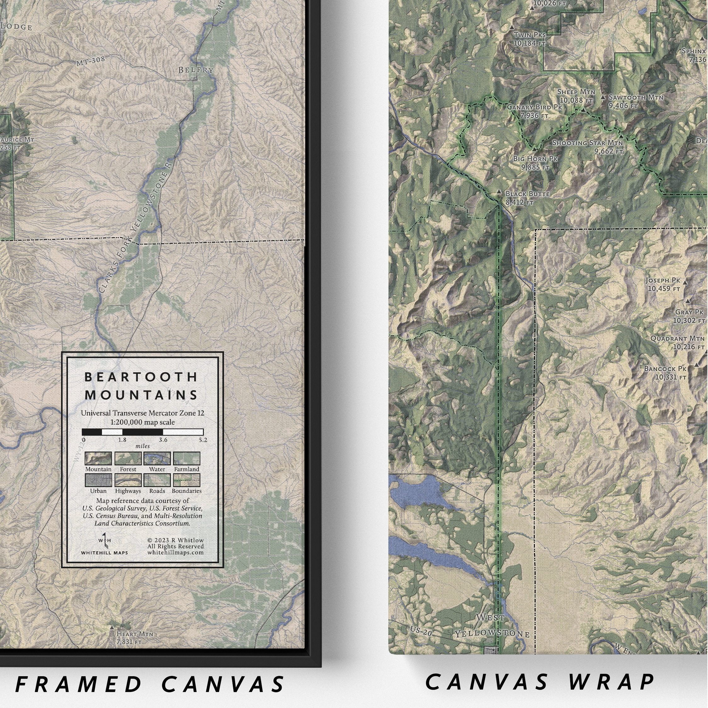
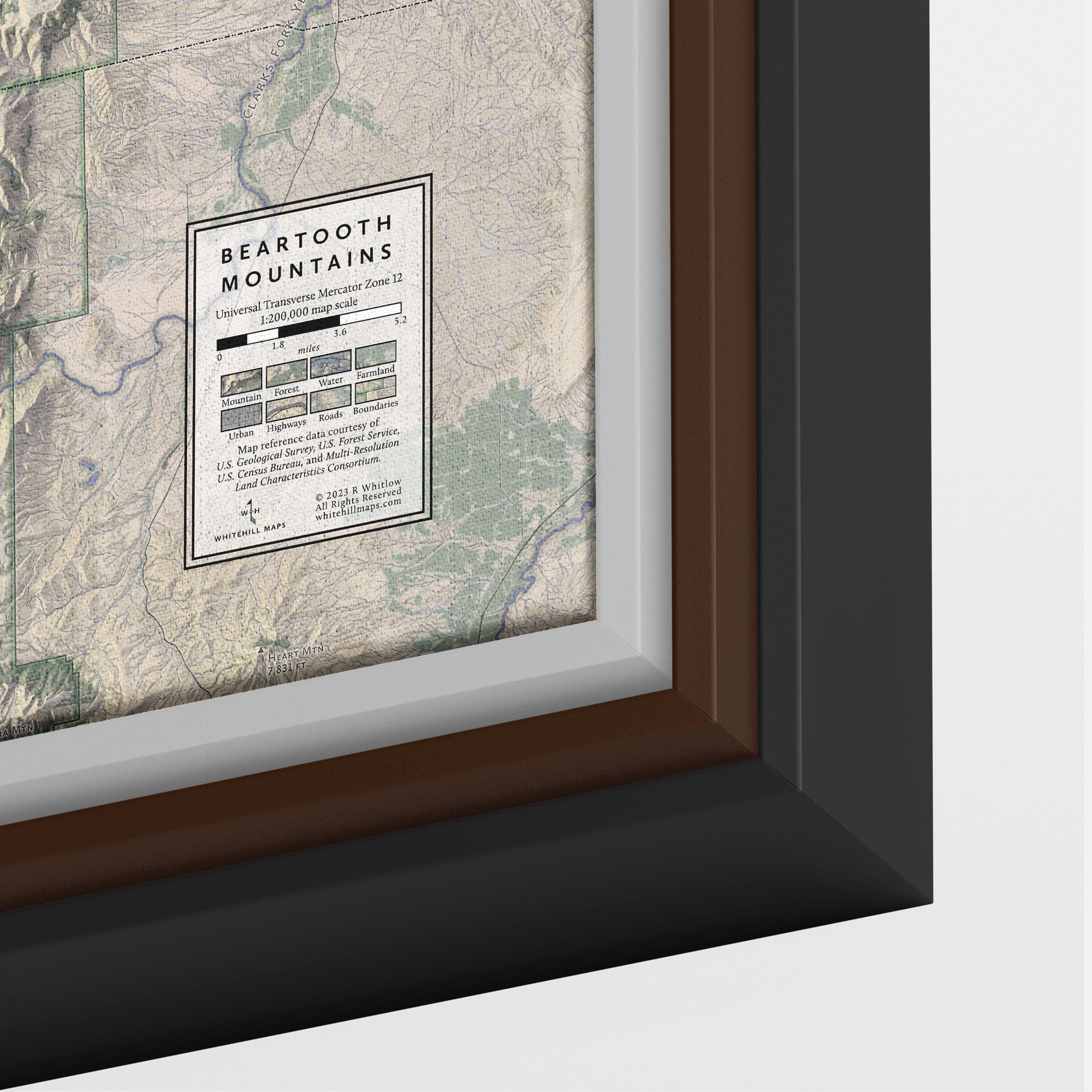
Maps are printed on canvas stretched around a solid foam core. Unstretched canvas, paper, and vinyl prints are also available. The canvas has a visible bump texture and that adds to the map’s 3d-like appearance. Canvas is dull, only slightly reflective, good for viewing in different levels of light. Floating frames are optional on all sizes. The float frame is set slightly back and away from the canvas. Both framed and unframed canvas wraps arrive ready to mount.
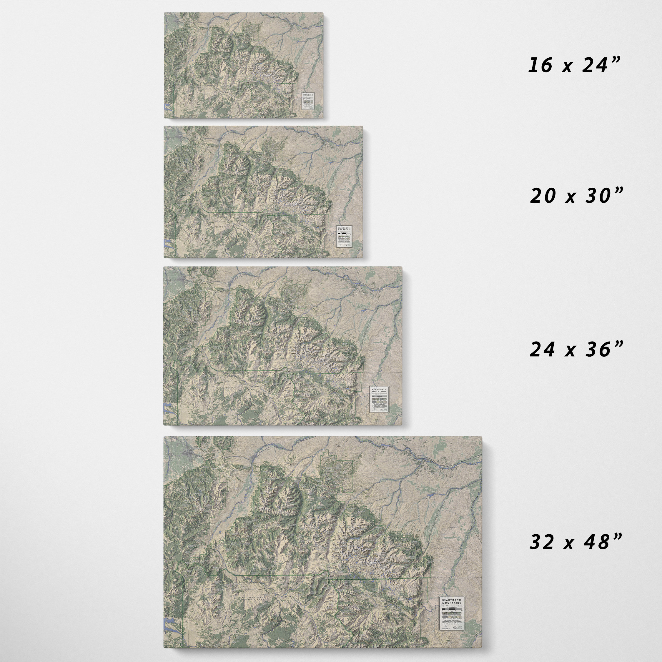
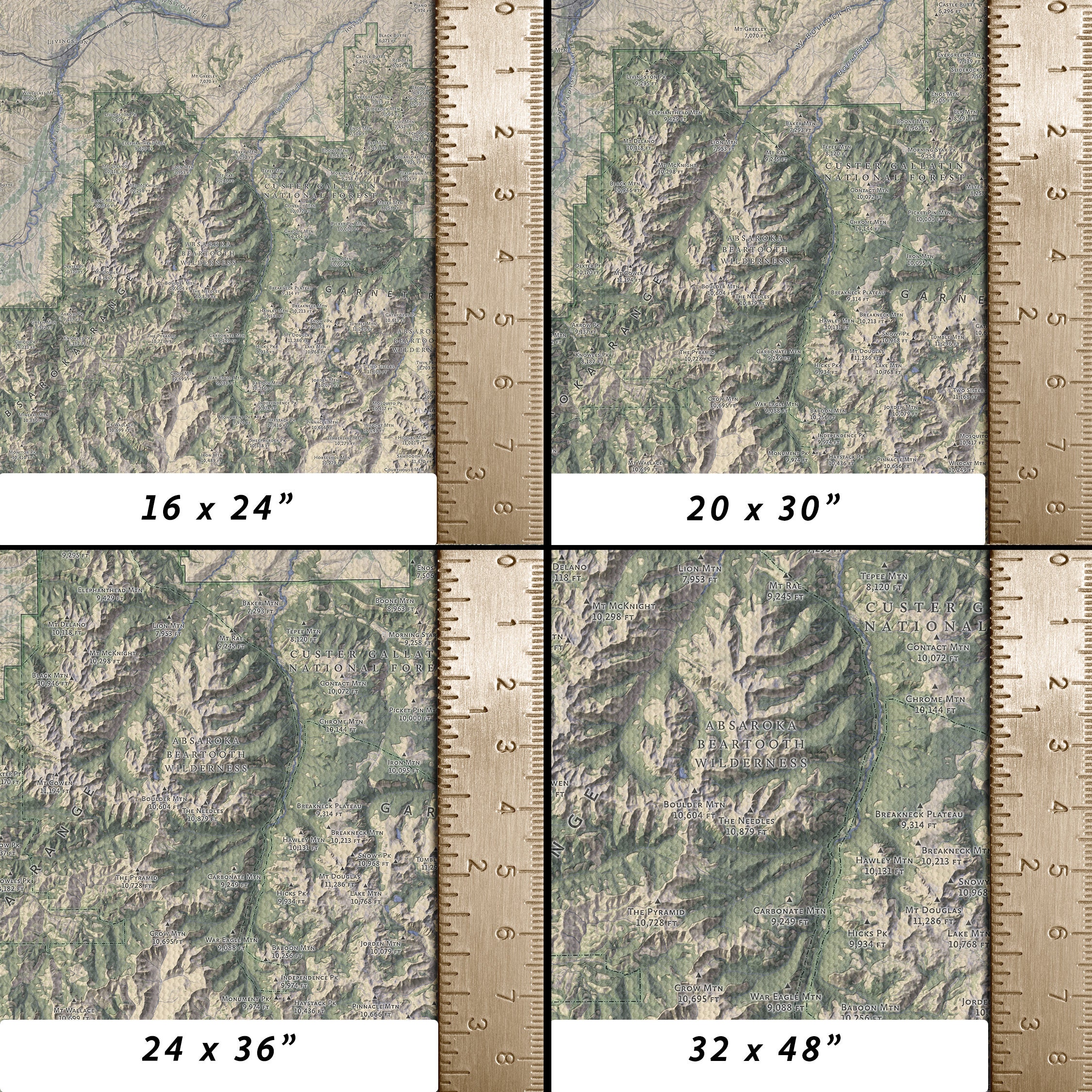
Canvas maps are available in 16x24”, 20x30”, 24x36”, and 32x48” sizes.
The maps are designed by Whitehill Maps and printed by a professional printshop in Longmount, Colorado. It generally takes three 3 days to print the map and another 3 for it to ship via UPS ground, for an average arrival time of 6 business days. Canvas maps ship wrapped in plastic and placed in large cardboard packaging. If your map arrives damage send me a photo and I will arrange a replacement ASAP.
Whitehill Maps is the outlet for Ray Whitlow’s cartographic experiments. Ray has been practicing GIS since 2005 and making maps since 2018. He uses ArcGIS, QGIS, and Photoshop to create photorealistic maps of the American Northwest, including Montana, Idaho, Oregon, and Washington. Visit the Whitehill Maps store to see stunning maps of the Bitterroot and Flathead Valleys, the Columbia Gorge, the Deschutes River, Puget Sound, and more! -
Shipping & Policies
Shipping from United States
Processing time
3-5 business days
Estimated shipping times
- North America : 3 - 5 business days
I'll do my best to meet these shipping estimates, but can't guarantee them. Actual delivery time will depend on the shipping method you choose.
Customs and import taxes
Buyers are responsible for any customs and import taxes that may apply. I'm not responsible for delays due to customs.
Payment Options
Returns & Exchanges
Returns & exchanges accepted within 30 days
Buyers are responsible for return shipping costs. If the item is not returned in its original condition, the buyer is responsible for any loss in value.
The following items can't be returned or exchanged
Because of the nature of these items, unless they arrive damaged or defective, I can't accept returns for:
- Custom or personalized orders
Conditions of return
Buyers are responsible for return shipping costs. If the item is not returned in its original condition, the buyer is responsible for any loss in value.
Privacy policy
Whitehill Maps collects shipping information and shares it with third parties (e.g. UPS) for the purpose of delivering your order. The Whitehill Maps Etsy shop may be required to maintain this information in order to comply with legal and/or tax obligations.
The Whitehill Maps Etsy shop does not collect or retain personal information for other purposes.
The above refers only to the Whitehill Maps shop. Please refer to Etsy's privacy policy for more information.Frequently Asked Questions
Sizing details
Each map's print size is included in the product title and description.
All maps printed on watercolor rag include a rough border approximately 0.5 inches wide.
All maps printed on canvas are stretched across a 1.5" fiberboard backing.Print Materials
Maps are printed either on textured watercolor rag or canvas wraps. Please message me if you would like a map printed on a different material.
Gift wrapping and packaging
All maps are packaged with plastic sleeves and cardboard reinforcement to protect them during shipment.
Maps 11x14" and smaller are shipped flat. Maps 12x16" and larger are shipped rolled up.
Gift wrapping for maps is not offered at this time.